Delhi Monsoon Delay: IMD says high-pressure ‘wall’ is stalling rains despite clouds
 Sep, 4 2025
What’s holding back the monsoon over Delhi
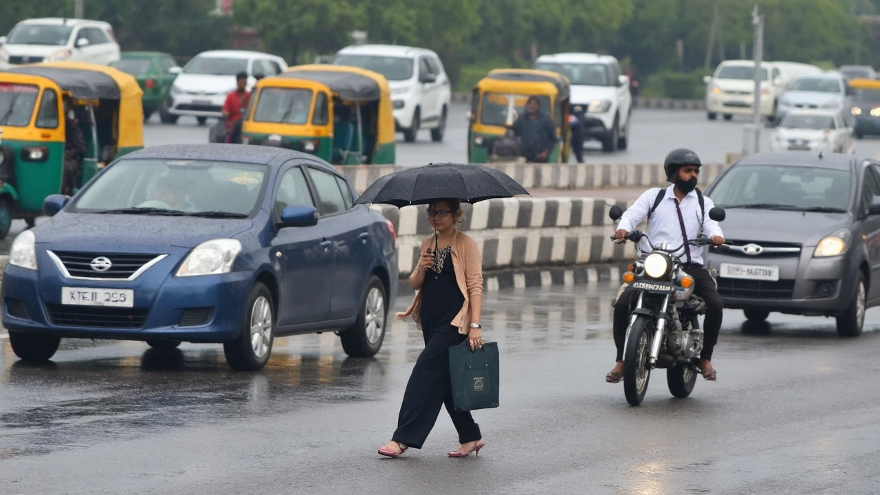
Thick clouds, sticky heat, and still no rain. That sums up the Delhi monsoon delay this year. The India Meteorological Department (IMD) keeps pushing back the arrival date because a stubborn high-pressure system is sitting over north India like a lid. That lid—an anti-cyclonic circulation at the middle and upper levels of the atmosphere—is stopping the monsoon trough from sliding north into the capital.
Here’s the simple version: monsoon winds want to surge up from the south, but this broad dome of high pressure over Delhi, Haryana, and parts of western UP is forcing air to sink. Sinking air warms and dries out. That kills tall clouds before they can turn into sustained rain. So you get overcast skies, higher humidity, even a few drizzles or patchy showers on the city’s edges—but not the organized rainfall that marks monsoon onset.
IMD’s latest monsoon map shows the Northern Limit of Monsoon (NLM) curling through Jaisalmer, Bikaner, Sonipat, and Rampur, but curiously skipping Delhi. That’s why Rajasthan, Haryana, and parts of Punjab are getting rain spells while the capital and narrow belts just west and east remain mostly dry. Forecasts first pointed to a June 24 arrival for Delhi, then slid to later windows. Each one ran into the same atmospheric roadblock.
Senior IMD scientist Dr. R.K. Jenamani says southeasterly winds have been feeding moisture toward Delhi from systems to the south, but the mid-to-upper level anti-cyclone keeps choking off vertical growth. In other words, the lower atmosphere is moist, the upper layers are not cooperating, and the result is a lot of cloud without the payoff.
There’s more going on. The Bay of Bengal branch—usually crucial for pushing the rain belt east and then north—has been comparatively weak. The Arabian Sea branch is strong, but it’s funneling moisture westward and along the coast instead of driving it deeper inland. Big climate drivers like ENSO and the Indian Ocean Dipole are near neutral. That’s not bad news, but it also means there isn’t an extra push in the background to speed things up.
On top of that, pulses that normally shake up the atmosphere—western disturbances or short-lived cyclonic swirls over north India—have been feeble. Dry northwesterly winds sneak in at times and undercut the moist flow. Put it together and you get a broad-scale block with just enough interruptions to tease the city but not enough to break the pattern.
Monsoon onset, by IMD rules, isn’t declared on mood or cloud color. It needs sustained rain over a set of stations, persistent southwesterly winds at low levels, and favorable cloud-top radiation signals. Delhi hasn’t checked those boxes yet. So even if a few neighborhoods catch a shower, it won’t count as “onset” until the wind and rainfall persist for long enough and across enough of the region.
What to expect next and how the city is coping
IMD expects the seasonal trough to nudge north in the next three to four days as the anti-cyclone weakens. If that shift happens, winds near the surface will turn more consistently southwesterly, cloud towers will rise higher, and rain bands could finally lock in. Watch for three signals that the block is giving way: a dip in daytime temperatures, a bump in wind speed from the southwest, and a run of widespread showers lasting over 24–48 hours.
Even with the delay, IMD’s seasonal outlook hasn’t soured. For the Delhi–Haryana–Chandigarh belt, the department still pegs rainfall as above normal for the season, part of an all-India projection of about 106% of the Long Period Average. That national number hides sharp regional contrasts. The western coast and parts of Maharashtra have been running high, while the northeast is staring at a weaker start.
Delhi’s timeline is famously jittery. The city saw the monsoon on June 25 in 2023, June 30 in 2022, and as late as July 13 in 2021. A late arrival doesn’t necessarily mean a weak season; it just shifts the rain calendar. In fact, when the monsoon does break in Delhi, it often arrives with two or three heavy bursts that can overwhelm drains. In 2024, the city clocked 228.1 mm in a single day—flooding major corridors and underpasses in hours.
Why are clouds so thick but stingy with rain right now? Think of a cap. The anti-cyclone creates a warm layer aloft—a temperature inversion—that acts like a ceiling. Moist air from the south can’t punch through it. You get flat, grey stratiform cloud, higher dew points, and an oppressive feel, but no deep convective towers. Without those towers, raindrops don’t grow big enough and widespread enough to count as a proper burst.
City life feels the squeeze in small ways. Without rain to flush the air, ozone levels tend to creep up on sunny breaks, and dust lingers when northwesterlies cut through. Power demand stays elevated as homes and offices run cooling longer. Water utilities juggle supply as neighborhoods wait for the usual early-monsoon recharge. And traffic? The first big shower after a long dry spell often lifts oil and grime off the roads, making surfaces slick—so the opening day of monsoon regularly brings more crashes.
Regional differences matter. Southwest Uttar Pradesh, parts of Haryana, and western Rajasthan are seeing similar delays thanks to the same blocking setup. Farther west, the Arabian Sea branch keeps the Konkan and Ghats active. Farther east, the slower Bay branch is one reason the northeast isn’t seeing the kind of early-season saturation it often does.
What breaks an anti-cyclone like this? Usually, one of three things happens. Either the monsoon trough creeps north far enough to erode the high-pressure pocket. Or a passing disturbance knocks a hole in the lid for 48–72 hours, letting convection explode. Or the background wind pattern tilts just enough to weaken subsidence aloft. IMD thinks a northward jog of the seasonal trough is the most likely lever in the short term.
Don’t expect non-stop rain once the onset is declared. Delhi’s monsoon rhythm is burst and break—two or three wet days, then a lull, then another spell. The danger window often sits right after onset, when drainage systems face their first stress test. Flood-prone zones—Ashram, Minto Bridge, ITO, parts of Ring Road, and several underpasses—tend to see quick ponding if the first burst arrives with 60–80 mm in a few hours.
For residents keeping an eye on the sky, a few practical signs help:
- Winds veer from variable or easterly to steady southwesterly through the day.
- Daytime highs dip by 2–3°C, but humidity stays high.
- Clouds develop vertical bulges by afternoon (towering cumulus), not just flat grey layers.
- Showers become widespread across the NCR, not just spotty cells near the Aravallis.
And some quick prep goes a long way before the first big burst:
- Clear balcony drains and building outlets; check ground-floor sump pumps where present.
- Avoid low-lying underpasses during the first heavy spell; take ring-road alternatives if you can.
- Keep phone alerts on for IMD nowcasts; the first two or three bursts tend to be the messiest.
- If you park on the street, move the car off slopes or near storm grates to prevent water damage.
One more nuance: a late onset can compress rain into tighter windows, which sometimes makes the peaks sharper. That’s why city agencies usually go on a higher alert in the first week after onset—desilting crews, pump stations, and traffic police ramp up in anticipation of a fast, heavy burst.
Bottom line from the forecasters: the setup that kept Delhi dry despite brooding skies is finally wobbling. If the anti-cyclone weakens and the monsoon trough shifts north as expected, the capital should step into monsoon conditions within a short window. Until then, the city is stuck under a lid—humid, cloudy, and waiting for the first clean break in the pattern.